Karez detection from satellite imagery
Mapping ancient irrigation systems in arid regions
Karez, or qanat, are ancient underground irrigation systems that transport groundwater over long distances using gravity. They have been used for thousands of years across arid and semi-arid regions and can provide water with very little evaporation loss and no need for pumping.
Many systems are still in use, while others have fallen into disrepair. Mapping where they exist can help document this infrastructure and support research into traditional approaches to water management.
I developed an image classification model to detect Karez systems from high resolution satellite imagery.
What can be seen from space?
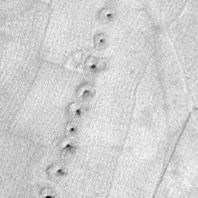
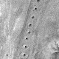
Although the tunnels themselves are underground, they are accessed through regularly spaced vertical shafts. From above, these appear as distinctive lines of circular features across the landscape.
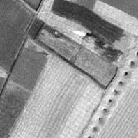
I used 1 m resolution OrbView-3 satellite imagery from the USGS archive and manually identified examples of Karez and non-Karez landscapes to create training and validation datasets.
Building the classifier
I trained a convolutional neural network using TensorFlow and Keras to distinguish images containing Karez systems from other landscapes.
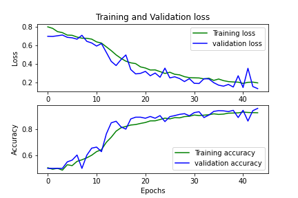
The dataset contained 2,960 training images and 740 validation images. I used image augmentation to increase the diversity of the training data and reduce sensitivity to the orientation and position of features within an image.

Results
This was an exploratory project to test whether Karez systems could be identified automatically from high-resolution satellite imagery. The classifier achieved a precision of 95% on the validation data, although I did not take the work through to independent testing on imagery from new locations.
The code and Jupyter notebook are available here.
Why this matters
Karez systems are an example of water infrastructure adapted to dry environments long before modern pumping systems were available.
Satellite imagery provides a way to identify and map these systems over large and remote areas. Automated image analysis can make that process much faster than identifying individual tunnel systems by hand, and could help document where this traditional infrastructure still survives.